Specifications
- Type:
- Cargo Airplane
- Condition:
- New
- Year Built:
- 2016
- Place of Origin:
- Beijing, China (Mainland)
- Model Number:
- F-11
- Material:
- Carbon Fibre + Aviation Aluminum
- Max take-off weight:
- 15 KG
- Cruising speed:
- 100-120km/h
- Radio Control Style:
- RC Model
- Power supply:
- gasoline engine
- white Function:
- aerial photography,mapping & surveying
- Wingspan:
- 2300mm
- Packaging Details:
- Standard Export Box
- Delivery Detail:
- 20 days
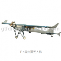
Body length:3.4m
Body width:0.7m
Wingspan:4.5m
Maximum take off weight:80kg
Maximum payload:25kg
Take-off and landing approach:catapult launch, runway landing, Parachute
Launch speed:60km/h
Sinking speed:70Km/h
Maximum climbing speed:5m/s
Cursing speed:100-140km/h
Maximum flying speed:115km/h
Flight endurance:10h
Maximum work height:Altitude 4500m
Radius of work task:100km
Maximum wind resistance:7level(10.8-13.8m/s)
Power system:Two cylinder two stroke 170cc
Launch system weight:200Kg
Fuel type:95#gasoline+two stroke lubricating oil
Spread length:12m
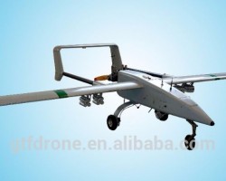
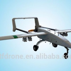
F-5 Fixed wing UAV
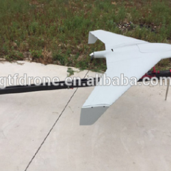
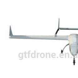
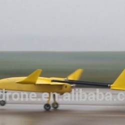
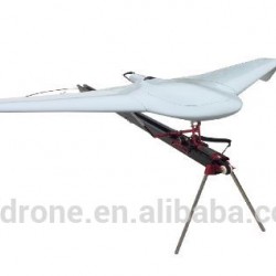
The F-5 system has high reliability and convenient maneuverability etc. Through optimized aerodynamic layout and equipped with automatic parachute ejection take-off system, it can be mounted a high precision stable 2-foot-tall tower, hyperspectral imager, hasselblad industrial camera and deep exploration instrument. Completely changed independently operating characteristics, provide users with more convenient, more reliable control, the use of more flexible and more simplified to manipulate personnel training requirements, the operation of F-5 can be 12 hours fast training, one key take-off, fully automatic flight routes, fixed-point landing. To compared with same weight UAV, F-5 has a relatively long flight time. After a series of aerial remote sensing and testing, F-5 remote sensing system has been successfully applied in aerial survey, disaster monitoring and assessment, emergency monitoring, forest fire prevention and fire fighting, investigation of land and resources and other fields.
Product overview :
F-5 adopted big lift-to-drag ratio and excellent performance of the high lift airfoils, provide more equipment installation space and longer battery life. Maximum task load is 25 kg, capable to carrying more pixels of image sensor. At the same time, F-5 system automation degree is high, the whole flight process using automatic ejection, automatic open umbrella, no special requirements for the take-off venue, it can adapt to the complex environment, greatly enhance the practicability of small electric Uavs for the common user. Key points of system:
1,Using high quality composite materials, high precision molds and all kinds of precision parts and electrical and mechanical equipment, guarantee the reliability and stability of the system;
2,Use advanced GPS navigation or RTK positioning system based on high precision flight control, through system integration and software system of secondary development, realize that the aerial could satisfy the requirement of spectral remote sensing and measuring process fully automated and over-the-horizon homework;
3,Equipped with independent development route planning software, according to the measured area polygon vertex coordinates, and all kinds of spectral remote sensing, aerial parameters, such as scale and overlap rate quickly generate optimal flight shooting files and task report.;
4,Equipped with portable ground control station or laptop, available through wireless data link control software real-time monitoring, and job status, flexible flight control of UAV;
5,Professional cameras and digital camera with stable gimbal which can effectively control the attitude of the image within a margin of error;
6,Gyro stabilized elector-optical gimbal, can make the camera stable in any location continuous video monitoring;
7,landing distance is short, don't need special runway, strong adaptability;
8,Strong wind resistance, F-5 can steady work under six level;
9,removable, it can be finished in 20 minutes assembly, debug and recycling without special tools. All the equipment can be loaded in a ten medium size bus.
