
Whether it’s with theodolites, levels, or transits, architects and surveyors have been trying to get the lay of the land for centuries. When humans took to the sky, being able to see the ground from a new perspective led to the rise of aerial mapping; and advanced mapping software has since taken the science of surveying to new heights. Surveyors have a tough job: whether they’re trekking out into the untamed wilderness or trying to find the perfect angle in a city street, it’s arduous and sometimes dangerous work, and that’s why it’s time for Drone Services china to give them a hand. Autonomous drone surveyors create “photomaps” from overhead photographs; removing distortion and introducing accurate measurements through ground sampling distances allow human operators to compile precise digital elevation models, contours, volume measurements, and more.
Topographic Survey & GIS Mapping
Drone surveying is a fast, accurate, and cost-effective alternative to traditional surveying. While a team of surveyors might once have had to traipse through the woods, modern drone technologies allow for the use of “geographic information system surveys” (GIS surveys) that capture, analyze, and correlate reams of data gathered from multiple drones. Drone usage drastically reduces the time spent collecting data, and a single flight can produce millions of data points that would take a team of humans weeks to gather. Not only is this method far more efficient and cost-effective than older forms of surveying, but the safety risks involved in surveying are drastically reduced – less time in the field means that there’s less risk to surveying teams in steep or unstable areas.
Drones & Photogrammetry
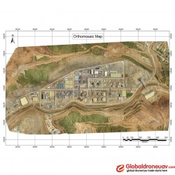
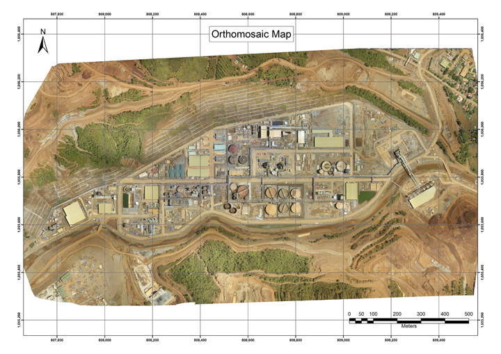
Mapping has always been a game of collaboration. It’s hard for one explorer to plot out an entire area by themselves, but if many adventurers combine their data, the easier and more efficient it becomes. That’s the basic idea behind “photogrammetry” producing image mosaics using software to combine multiple drone photographs together, removing distortion and providing accurate measurements. When aerial images are combined with ground control points, the softwarecan produce a scalable, high-definition orthomosaicmap of a site. From here, it’s possible to produce three-dimensional models, contour maps, digital surface models, and other vital maps in a variety of formats.
Common Challenges for Vertical
Safety Concerns
- Surveying has always been a risky job: cliffs, mountains, abandoned mineshafts, and other geographic terrain features must always be treated with caution. Using drones to map out these treacherous locations removes the risk of injury to surveyors.
Logistics and scheduling
- Finding the time and effort to map out a stretch of unexplored terrain can be a challenging endeavor: finding personnel, hiring transport, insuring equipment, and recruiting local guides all take their financial toll. With drones, the challenge is simplified: one man and a fleet of drones can cheaply and efficiently map an equivalent area.
Accurate, up-to-date information
- Every year brings new challenges and changes – the river you mapped last summer might have burst its banks over the spring and turned the surrounding forest into a swamp. As drones increase the speed of surveying, Drone Services china will provide up to date information: getting many simultaneous eyes “on the ground” gives up-to-the-minute information whenever you need it.
Use of Drones in Surveying Industry
Aerial surveying services
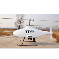
- UAV/Drone aerial surveying allows for very high-detail photography – unlike helicopters and jet planes, drones can fly much lower to the ground, allowing them to snap higher-quality shots and to compile aerial maps. We offer services throughout ontario and china
Solar panel surveying
- Green energy is the wave of the future, but one of the biggest hurdles to overcome is the question of determining where to build large solar farms.
- Our company offers regularly scheduled drone surveying options for solar farms, allowing for regular, precise, aerial photography that produces highly detailed images for both construction and maintenance purposes.
Wind farm surveying
- While traditional surveying on wind farms requires climbing the turbines to take photographs or snapping shots from the ground, these can be dangerous or inaccurate.
- Our aerial drone wind farm surveying allows us to create aerial maps and generate composite photogrammetry maps.
Farm surveying
- Precision surveyors are imperative in major agribusinesses, and we offer a comprehensive range of surveying options for today’s farmers.
- Through aerial views, Drone Services china can monitor soil, water, and crops throughout the season and provide thermal, orthomosaic and GIS maps using GPS drones to aid in crop rotation and watershed management.
Aerial inspection
- Our drone aerial inspection service is available in all regions of china, boasting a mobile team and utilizing the latest UAV technologies.
- Our precision surveyors can take aerial photographs to produce GIS maps and UAV surveys to produce accurate materials for engineering, construction, and farming. We service both major metropolises and rural regions equally and accurately across China.
Thermal aerial photography
- Aerial thermal imaging has a wide variety of applications, including precision surveying and emergency services.
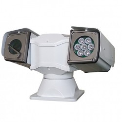
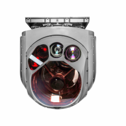
- Drone Services China uses two types of unmanned aerial vehicles: drones equipped with a thermal camera and drones utilizing a combinational high-qualityDSLR and thermal camera. Our drones can meld thermal and conventionalimages to create precise representations and maps.
Volume analysis
- Drone photographers can perform volume analysis based on photographic data driven from 2D models, using specialized software applications.
- Our service includes stockpile volume analysis and cut/fill quantity analysis.
Aerial mapping
- Drone Services China specializes in both 2D and 3D mapping, using a wide range of aerial drones and mapping systems.
- Our fleet of drones includes camera drones ranging from 12 MP to 42MP camera systems.
- Additionally, our service is not limited to mapping, as we can perform elevation and stack volume analysis.
Orthophotos
- Our aerial mapping service composites digitally corrected and remapped aerial photographs that can be assembled into a single high-quality map.
Georeferencing
- Drone Services China utilizes two primary approaches to georeferencing: the manual approach, or services at our aerial mapping office.
3D mapping
- Drone Services China produces extremely accurate models of landscapes and structures using 3D point-cloud and mesh models.
- Our drone 3D mapping analysis is done at our Hamilton office; however, we offer services across China.
Thermal mapping
- Drone Services China uses thermal camera-equipped drones for thermal mapping applications.
- We can apply georeferencing techniques to create standalone thermal maps and orthomosaicsthat combine both conventional photographs and thermal images.
Volume analysis
- Drone Services China can use the data collected in our initial analysis to perform volume calculations.
Elevation & surface modelling
- Our aerial mapping series can be used for Digital Elevation Modelling (DEM) and Digital Surface Modeling (DSM) to construct accurate geospatial maps.