

Specifications
- Style:
- Radio Control Toy
- Type:
- Airplane
- Power:
- Battery
- Material:
- Plastic, : metal
- Plastic Type:
- ABS
- Scale:
- 1:5
- Radio Control Style:
- RC Hobby
- Place of Origin:
- Guangxi, China (Mainland)
- Brand Name:
- Feiyu-tech
- Model Number:
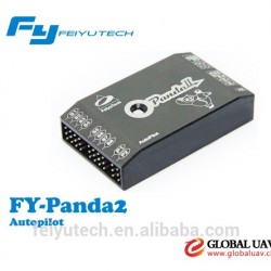
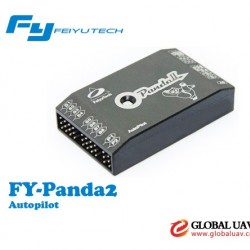
- FY-Panda2
- For Vehicle Type:
- : Airplanes
- auto take off?:
- : YES
- auto land?:
- :YES
- auto take pictures?:
- :YES
- color:
- : black
- Power Source:
- : Electric
- category::
- RC airplane controller
- use for?:
- UAV FPV
- Packaging Details:
- RC Airplane Controller-FY-Panda2&FY-606 Data Modem Radio Control System
22*16*4
- Delivery Detail:
- 1day
RC Airplane Controller-FY-Panda2&FY-606 Data Modem Radio Control System
we are the company design,develop ,and produce the flight control system for UAV and FPV
we have all kinds of RC autopilot and aircrafts
our price is competitivefor we are the manufacture we are the source
we can ensure you the best quality and the strong technical support and the first rate service after sales
AerialphotographybyPanda:
http://v.youku.com/v_show/id_XMzc5Mzc3MDYw.html
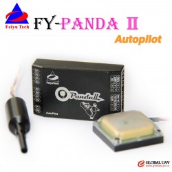
thepackageincludes
1.PandaAutopilotmodule;
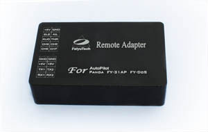
2.PandaRemoteAdapterBoard;
3.FYGPS(10HZ)Module;
4.FYCS100CurrentSensor;
5.GroundStationGCSSoftware;
6.RelatedWirings.
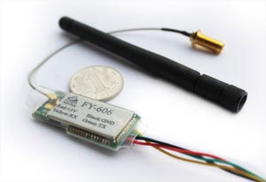
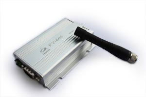
7.FY606DataRadio×2(Transmitpower:100MWFrequency:2.4GHZ)
8.Antenna*2
9.Relarewirings;
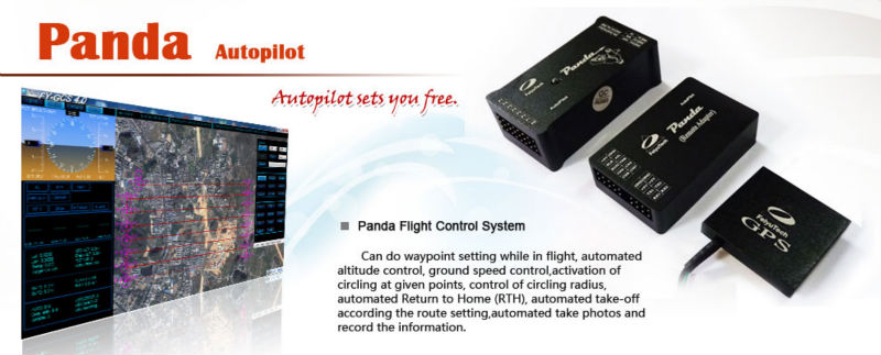
BriefIntroduction
PandaAutopilotmainlyincludeAutopilotmodule,GPSmodule,Remoteadaptermodule,communicationsystem,GCS
Theparametersinclude(butarenotlimitedto)
Waypointsettingwhileinflight
Automatedaltitudecontrol
Groundspeedcontrol
Activationofcirclingatgivenpoints
Controlofcirclingradius
AutomatedReturntoHome(RTH)
Automatedtake-offaccordingtheroutesetting
Inadditiontherearemanyprotectedmode,canthegreatestdegreeofguaranteereliableandflightsafety.
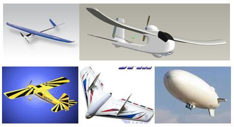
AircraftSuitability
Conventional,Vtail,elevon,noaileron,etc.Variouskindsoflayoutformofsmallandmedium-sizedvehicleautomaticnavigationanddriving.
Allkindsoftheairshipautomaticnavigationanddriving.
Maincharacteristic
1.PANDAprovideshighprecisionflightattitudemeasurementandcontrolthroughtheutilizationofanintegrated32bitsmicroprocessor,GPSreceiver,three-axisMEMSgyros,three-axisaccelerometer,three-axismagneticsensor,accuratebarometricpressuresensor,attitudealgorithm,Kalmanfilteringanddatafusionalgorithms.
2.Combinedtheattitudemoduleandthecontrolmodule,getmoresmallvolumeandlighterweight.
3.Realizeautotakeoffandautoland,maximumreducetheoperatingpressure.
4.Canaccordtotheplaneinternalspacetoadjusttheinstalldirection,easiertocompletetheconnection.
5.10HzdatarateGPSreceiver,35secondsfastpositioningtimeandaccuracyof2.5metersCEP.TheGPScanrecordthepositionalparameterwithbattery,thelocatingtimegreatlyimproved.
6.100HZinnerattitudecontrol,10HZouternavigationcontrol.
7.Multi-channelmixed-controloutputcanbeadjustedwithease.Thecontroloptionsinclude:
Elevatorandruddernavigation
Elevator,aileronandruddernavigation
Elevatorandaileronmixed-control(elevon)navigation
V-tailruddermaybeused,howeverathirdpartymixerhavetobesuppliedbytheuser.
8.Threecontrolmodes:
ManualMode
AFSSactivated(ActiveStabilization)Automaticnavigationcontrol.
9.Twoautomatednavigationcontrolmodes
Airroutenavigationmode
Mousecontrolledflightmode
10.Threespecialflightmodes
Fixedcirclingmode
AutoReturntoHome(RTH)mode
Autotake-offmode.
11.AnystandardRCtransmitterandreceivercanbeusedwiththissystem.
12.AutomatedRTH(ReturntoHome)protectionwhenthereisabreakinGCScommunicationlinkviathedataradios.Thistimethesystemisworkingonlyinthedataradiocontrolmode.
13.PandacanIntegratedautomaticandmanualaerialphotographytriggering.EquidistanceorTimingtakingphoto.CombinewiththePOSdatarecordmodulecanrecordthecurrentflightattitudeinfoofthetakingphotopoint,forexampletheLongitude,latitude,altitude,speed,etc.
14.TheGCSsoftwarehelpsintegrateAutomatedandManualflightcontrolmodesinaneasytousedisplayinterface.
15.TheGCSsoftwareincludeselectronicmapformatting.Byusingtheelectronicmap,aircraftrouteandtaskscanbemodifiedinreal-timeviayourGCScomputer.
16.RealtimedisplayontheGCSincludesflightparameterssuchasmainpackvoltage,mAhconsumed,Ampdraw,GPSsatellitestrengthandtemperatureoftheautopilotunit.
17.AllflightparametersaredownloadedautomaticallybytheGCSforinstantplayback.
18.importANT:GCSFunction
WhenusingtheDataRadiotocontroltheaircraft,thecontrollingsignalsfromtheRCReceiverisdirectlysenttotheRemoteAdapterandconvertedtodigitalsignals.TheDataRadiowillthenuploadthecommandstoyouraircraftviathedataradio.
TheGCSisonlyusedtomonitortelemetryandflightstatusoftheaircraft.Transmissionofcommandsisminimal.i.e.theaircraftismainlycontrolledbyyourRCTransmitter.Theautopilotstillcanrealizemostofthefunctions(forexample,airroutesetting,RTH,circling)withouttheGCS.
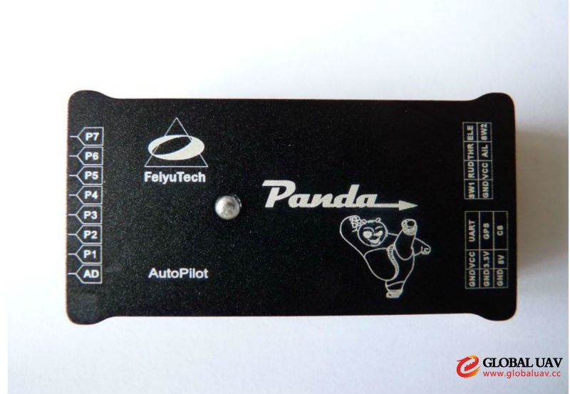
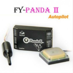
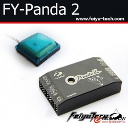
RCAirplaneControllerPanda2Autopilotmodule
Itintegratedthree-axisMEMSgyros,three-axisaccelerometer,three-axismagneticsensor,accuratebarometricpressuresensor,Flightmastercontrolmodule,responsiblefortheattitudemeasuring,thetaskplanningandflightcontrol,etc.
RCAirplaneControllerPanda2GPSReceiverModule
GPSreceivermoduleisprovidedthelocationinformationsuchasspeed.
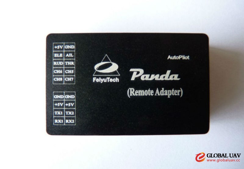
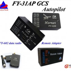
Radio control system Remoteadaptermodule and data module
PandacandirectconnectionRCremotecontrolreceiver,alsoitcanusetheremoteadapteranddataradiotoenhanceremotedistance.Theroleoftheremoteadapteristurningreceiversignaltodigitalsignalfordataradio.Commonremotecontroldistancegenerallyisat600meters,dependingontheperformanceoftheremotecontrolandtheRCreceiver.Thiscannotmeettheneedsoflongdistance,afterusingdataradio,remotecontroldistanceisdecidedbydataradio,youcanreachmorethan10KM,completelysolvetheproblemoflong-rangeFPVflight.DataradiocanalsobeconnectedtotheFY-GCSgroundstationsoftwaretomonitortherecordingflightpathanddata.
Learnmorepleasereferto:RemoteAdapterFY-602DataRadioFY-605DataRadioFY-606DataRadio
GCSgroundstationsoftware
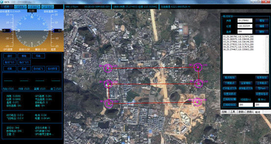
GCSgroundstationsoftware,usedtosettheflightparameters,missionplanning,monitoringinflight.SoftwareintegrationofelectronicmapfunctioncanthroughthemapsoftwaretheGoogleearthlivemapoutintotheGCSsoftware.Themainfunctionis
ParameterSettings—Controlparameterssetting,coursesetting,etc
Realtimemonitoring—Itcanmonitorflightattitude.AndviatheGCSsoftwareyoucanchangetheflightaltitudeinrealtimeandrealizethemouseclickflight.
Recordandmonitoringflight—YoucanmonitoranddownloadflightpathviathGCSsoftwareinyourcomputer.
Learnmorepleasereferto:GCS4.0