
Specifications
- Style:
- Radio Control Toy
- Type:
- Drone
- Power:
- Battery
- Material:
- Plastic
- Plastic Type:
- ABS
- Radio Control Style:
- RC Hobby
- Place of Origin:
- Guangdong, China (Mainland)
- Brand Name:
- JTT
- Model Number:
- T60
- Battery:
- 20000mah 22.2v 6s battery
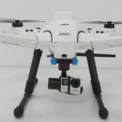
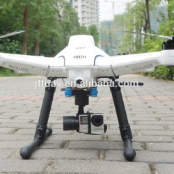
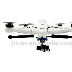
- 3 Axis gimbal:
- achieve motion in 360 degree
- wireless video transmission system:
- 2K or 10K for option
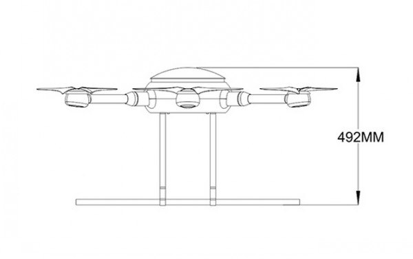
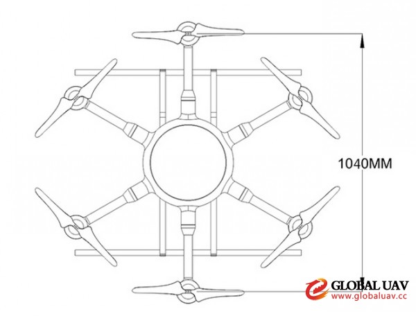
- Weight(without playout):
- 5.8kg
- Packaging Details:
- Packed in Aluminum case
- Delivery Detail:
- 20-45days
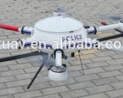
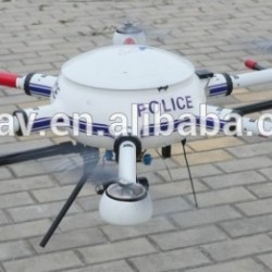
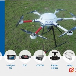
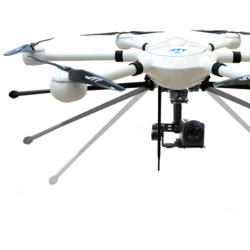
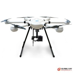
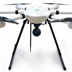
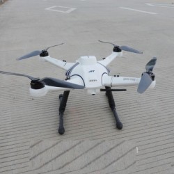
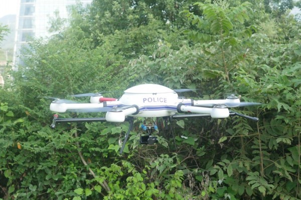
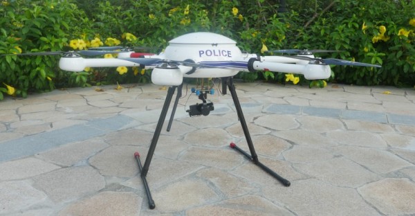
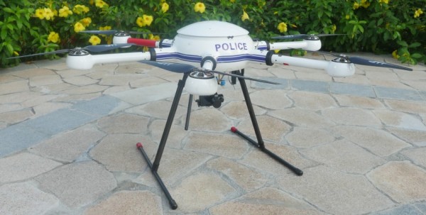
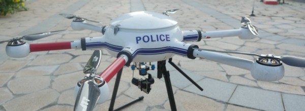
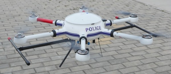
JTT Professional FPV Unmanned Aerial Survey UAV Flying Camera Drone
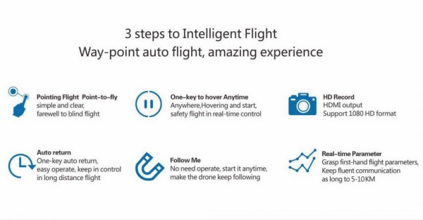
Pointing flight (point-to-fly, simple and clear avert bling glight)
HD shooting (HDMI output support 1080 format)
Follow me (no need operate, start it anytime make the follow target and photography)
One-key to hover (able to hover at anytime, make sure the flight to e under control)
Auto return voyage (one-key aotu return voyage, easy operate, avert to lose control, because of the long distance flight)
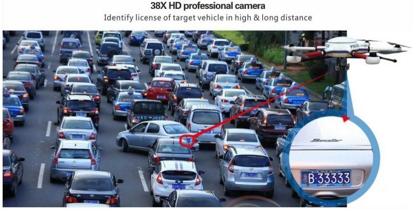
Real-time Data (keep posted of first-hand flight date, 20km distance of fluent communication.
Feature
-landing electrical propulsion UAV,long endurance lasts up to 60 minutes
-Be equipped with 3-axis gimbal to achieve motion in 360 degree under self-stable and physical suspension system
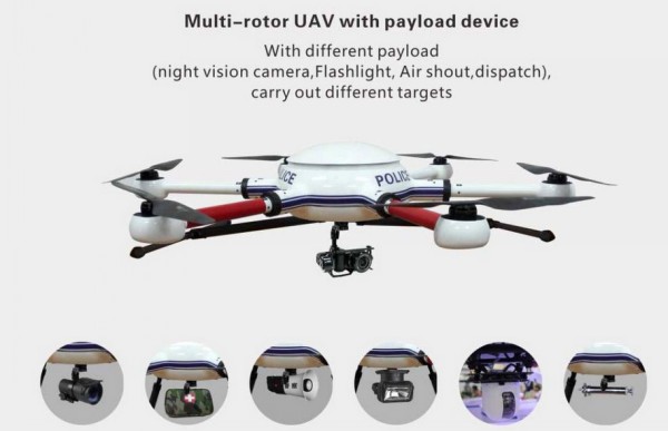
-Extensible airborne equipment with the infrared thermal device, professional airborne equipment.
-Automatic take off and landing, automatic lock height, automatic return, polar coordinate flight.
-Be capable of equipping with action camera and compact optoelectronic pod
Specification
|
Weight(without playout) |
5.8kg |
|
Max payload capacity |
3.5kg |
|
Max flight speed |
20m/s |
|
Maximum flight height |
2500m |
|
Max Flight ime |
50-60mins |
|
Video transmission distance |
5-20km |
|
Max Wind resistant |
level 7 |
|
Max ascent speed |
5m/s |
|
Max descent speed |
4m/s |
|
Hover accuracy(safe flight state) |
±0.5m/s, horizontal:±1m/s |
|
Gimble: |
JPG03 3-axis gimbal |
|
Angular Vibration range: |
±0.03° |
|
mounting |
detachable |
|
controllable range |
Pitch:±360° Pan:±30 |
|
Mechanical Range |
Pitch/Pan: ±360° |
|
Max Controllable speed Pitch |
±145°/s |
|
Pan |
±145°/s |
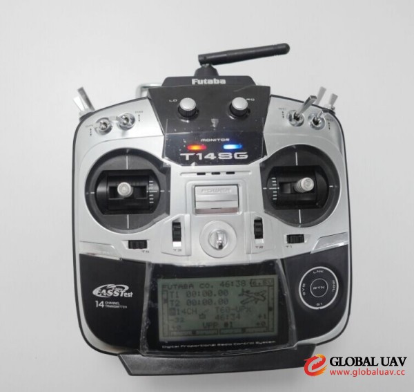
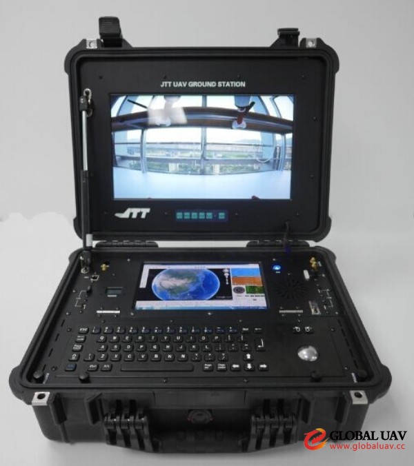
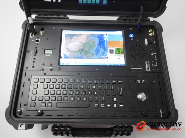
Professional Ground Station
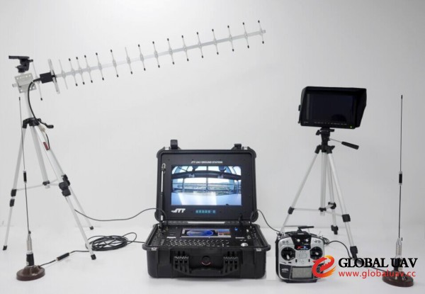
Remote Control